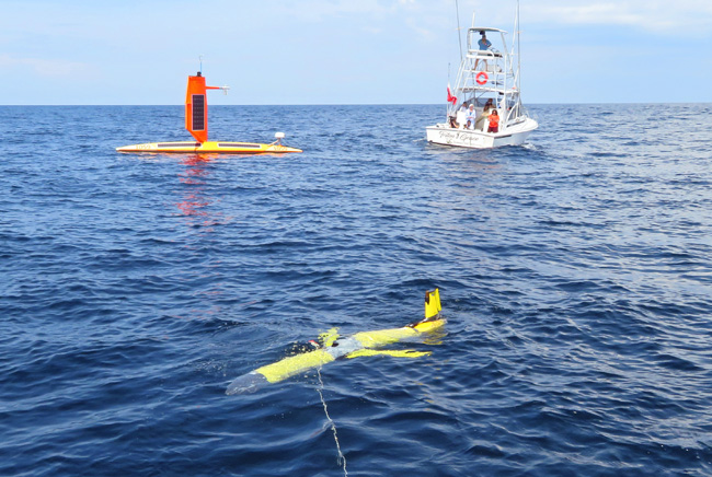
The UGA Skidaway Institute of Oceanography and Saildrone recently conducted a joint exercise utilizing autonomous underwater vehicles (gliders) and autonomous surface vessels called saildrones at Gray’s Reef National Marine Sanctuary. Beginning in 2021 and continuing this year, underwater gliders and saildrones have been coordinated to work together during hurricane season to collect oceanographic data and improve hurricane forecasts. Paired teams of gliders and saildrones will operate in the Caribbean, Gulf of Mexico, and in the Atlantic Ocean off the southeast US.

A UGA Skidaway Institute glider and a saildrone operate together at Gray’s Reef National Marine Sanctuary.
Gliders are torpedo-shaped crafts that can be packed with sensors and sent on underwater missions to collect oceanographic data. The gliders measure temperature and salinity, among other parameters, as they profile up and down in the water. Equipped with satellite phones, the gliders surface periodically to transmit their recorded data during missions that can last from weeks to months. The data from the gliders is contributed in real time to national and international repositories of ocean and atmospheric data to improve ocean and atmospheric models used in hurricane forecasting just hours after the data are collected.
The gliders are piloted by technicians at UGA Skidaway Institute and other partner institutions.
Saildrones are uncrewed surface vehicles powered by wind and solar energy, and remotely piloted via satellite telecommunication. They measure solar irradiance, barometric pressure, air temperature, humidity, wind, waves, water temperature, salinity, chlorophyll, dissolved oxygen and ocean currents. This information, in combination with measurements of surface short- and long-wave radiation, can be used to understand when, where and how heat and energy are exchanged between the ocean and atmosphere. The Saildrone Explorers deployed in this hurricane season are equipped with specially designed hurricane wings. The shorter, more rugged wing is designed to withstand hurricane strength winds and waves.


